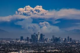
A rare “particularly dangerous situation” lookout for the coming days in Los Angeles and Ventura counties has been issued by the National Weather Service office.
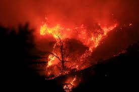
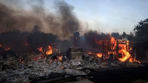
The previous time a red flag dangerous situation was put in place was a month ago on Nov. 5, when forecasters warned of extreme fire weather behavior. Then, a day later, on Nov. 6, the Mountain caught fire in Ventura counties. More than 240 buildings were razed, and flames were whipped by powerful winds onto Ventura counties. Becoming the third-most-destructive wildfire in Southern California since 2013.
Before November of this year, the last time a red-flagged dangerous situation popped into the world was in 2020. Almost Four years ago
‘Robbie Munroe, a weather service meteorologist, said, “Particularly dangerous situation red flag warnings should, on average, occur only once every three to five years. But it has now happened twice in the same fire season, just as in 2020 — once in October and another in December.”
Munroe warned conditions to begin around 8 p.m. Monday and last through 2 p.m. Tuesday. This type of fiery weather might be “Similar in magnitude.” to the howling winds Santa Ana winds event on Nov. 5 and 6 that fueled the mountain fire.
The fiery weather conditions were expected to be “Extreme.” and “extraordinary.” Munroe stated
“This is a very dangerous situation with the potential for large and also dangerous, life-threatening fires, should a fire ignite.” Winds were expected to ramp up as early as 4 p.m. Monday.
The dry, windy, and vegetation-desiccating conditions are similar to those that kindled the Thomas fire in 2017. That very fire was Southern California’s second-most destructive fire since 2013. Fire destroyed more than 1,000 structures in Ventura and Santa Barbara counties. (The region’s most destructive fire in that time frame was the Woolsey Fire 2018, which razed more than 1,600 structures in Los Angeles and Ventura counties.
There’s a key focus with forecasters during this windy event: the traditional Santa Ana wind corridors of Los Angeles and Ventura counties.
Santa Ana winds around this time of year. When a high-pressure system builds just enough in the Great Basin, Over Nevada and Utah, it seeks a relief valve off the coast, where low pressure is present.
Canyons and valleys can transform into wind tunnels in these extreme conditions, and sinking wind blows at high speeds en route to the beaches, generally in a Northeast-to-southwest direction. Gusts of up to 80 mph even, a tiny little fire can boom like that. Int urn whipping embers at astonishing speeds and leaving firefighters with only a few options other than trying to get people to evacuate.
A Santa Ana wind corridor to watch will be that of the Santa Clara River Valley, which essentially funnels air sinking from a high-pressure area above the high desert to the Ventura county coasts by way of Santa Clarita, which is why locals must keep cation. A red flag may mean it’s not 100%, but it doesn’t mean it won’t happen at all. To those who aren’t in the area but have family or friends there, keep an eye out for them.

